
Page 20 - Energize April 2021
P. 20
NEWS
Handheld scanner enhances digital engineering skills
any of South Africa’s assets packages to provide context for the design teams, reducing reliance on repeated site visits by
have outdated or missing bringing the outside world into the office space.
Mrecords. Whether privately- However, while Zutari’s mature 3D laser-scanning offering has proven invaluable in
owned or part of State infrastructure, mapping indoor spaces to sub-millimetre tolerances, giving its designers and professional
missing records are unfortunately a partners confidence that the designs are relevant to the actual physical spaces on-site, there
common problem. Without accessible have been notable gaps.
data, professional teams are hamstrung These include spaces where layouts are needed quickly, or complex layouts where the
at the outset of projects, having to make interaction between adjacent and interconnected spaces has to be understood in a timeframe
assumptions on the layout, composition too brief to undertake conventional 3D scanning.
and condition of facilities. Another issue is speeding up the process of familiarising designers with a remote site,
Surveying buildings is a time- in addition to rapidly capturing the maximum quantity of data, both geometrically and
consuming activity, often not budgeted for visually, in an integrated manner so that it can be accessed effectively by engineering
in the early stages of a project’s start-up. design applications.
All too often the professional teams rely on “We tested a variety of these scanners, and were most impressed by the functionality of the
educated guesswork and one or two site SLAM system to enable rapid collection of data, which we used to extract floorplans, volumetric
visits with photographs to formulate their spaces and locate plant and equipment in buildings, all as part of our hands-on testing of the
initial project proposals. available options,” explains Matchett.
“When we execute engineering The main requirements were to be able to spend the shortest time on-site to capture a
projects, we rely on comprehensive comprehensive overview, to enable anyone else to visit the site virtually within a day or two.
base data. Projects that involve existing The system also had to provide a robust processing interface to combine multiple scans of large
structures and facilities require accurate facilities. After extensive testing, the Leica BLK2GO scanner was acquired.
records of existing conditions. Without The Leica BLK2GO’s so-called ‘GrandSLAM’ technology combines LiDAR SLAM, Visual SLAM
proper data, our designs cannot be and an IMU to deliver best-in-class handheld mobile mapping performance for large indoor,
founded on fact,” stresses Zutari Digital outdoor, underground, complex and multi-level spaces. The scanner identifies different surfaces
Practice Lead Richard Matchett. and unique geometry in LiDAR data, which it analyses to calculate a 3D position.
Zutari has met the challenge Three panoramic cameras identify similarities between consecutive images to calculate
head-on by investing significant time the scanner’s movement through 3D space. While walking with the scanner, the IMU (Inertial
and resources to investigate various Measurement Unit) senses the movement to calculate the change of position in 3D space.
technological approaches to capture “We believe that it is the right tool for the job. This is testimony not only to our confidence
the reality at its sites in digitised form, in the use of this technology, but to our dedication to harnessing innovation to augment our
using virtual environments to assess and engineering skills in the digital world,” concludes Matchett.
understand those spaces in a scientific,
integrated manner. Contact Rashree Maharaj, Zutari, Tel 012 427-2000, Rashree.Maharaj@zutari.com
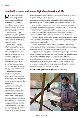
This has resulted in its recent
acquisition of the Leica BLK2GO
handheld imaging laser scanner,
believed to be one of only two available
in South Africa at present. The scanner is
an example of an innovative technology
known as Simultaneous Localisation and
Mapping (SLAM).
SLAM is based on an algorithm
that combines laser technology with
photogrammetry and data from
movement sensors. The handheld laser
device contains the scanner, cameras and
movement sensors in a single package.
When the scanner is carried through
an environment, it records 450 000
measurements per second in all directions
to incrementally accumulate a 3D picture.
In contrast, Zutari has been using
drones for over two years to capture site
conditions, adds Reality Capture Leader
Louis De Klerk (Jnr). The point clouds and
ortho-imagery derived in this manner
are used in its design and spatial analysis
energize | April 2021 | 18